EXPERIENCES / KIMBERLEY
Carr Boyd Explorer
Overview
Two sections, either of which can be done on its own.
Carr Boyd South: 24-30 April
- Boat across Lake Argyle to the start of the walk.
- The tallest waterfall in the range.
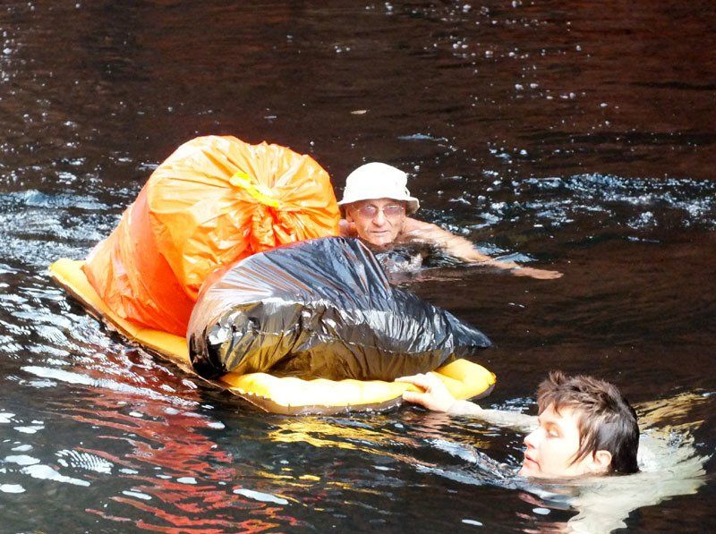
- Deep gorges and more pack floats than on any of our other trips.
- Helicopter transport to the start of the second walk.
Carr Boyd North: 30 April - 7 May
- Helicopter transport to the start of the second walk.
- Waterfalls, waterfalls and more waterfalls
- Beautiful camps.
- Easier walking than the first section.
KIMBERLEY
April 24
- May 7 2022
Section 1: Southern Carr Boyds
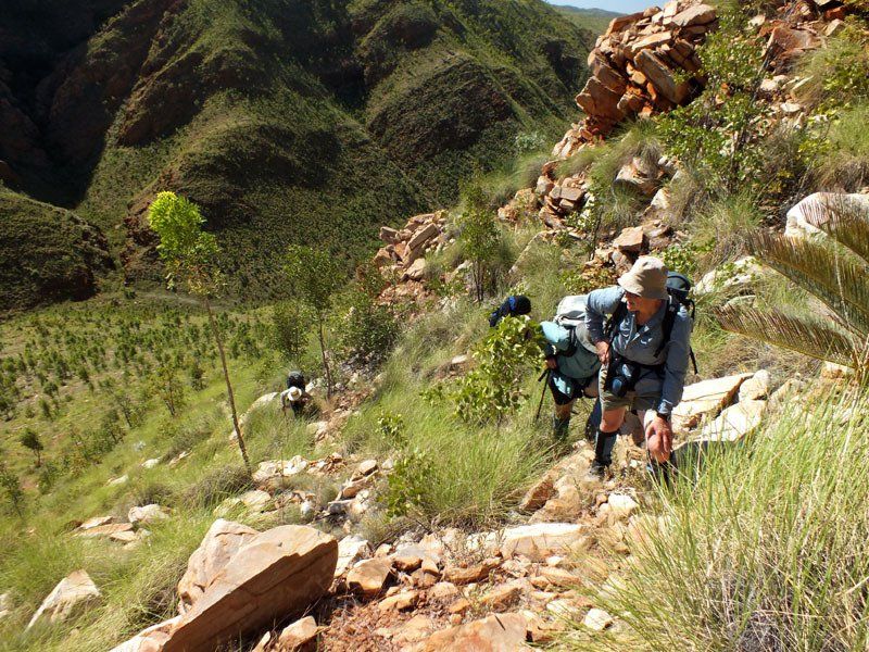
From here, we work our way up the gorge and onto the plateau. The climb is fairly steep. Parts are as difficult as anything we encounter on the rest of the trip. Once on top, the walking becomes easier and we should be able to get to a pool in time for lunch and a swim.
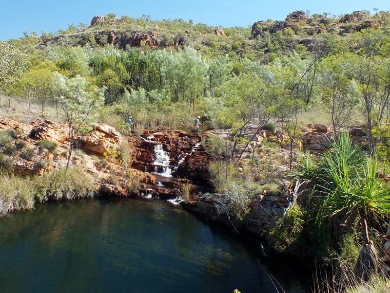
As we continue, we get some spectacular views down the gorges below. Every night, we camp next to yet another pool. Every day brings more views and swims.
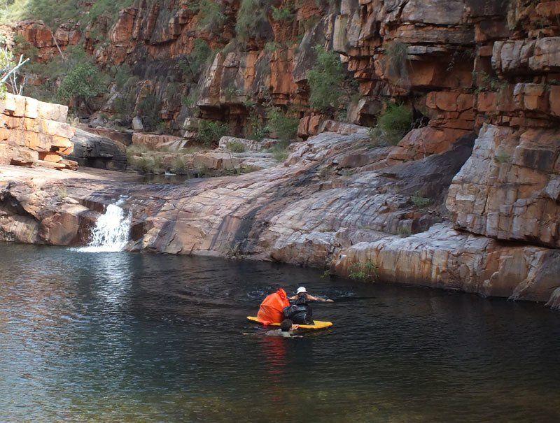
Eventually we drop into one of the most spectacular gorges in the entire range. We follow this downstream to the narrow gap where it exits the southern range, floating our packs on several occasions.
Once through the gap, we continue out into the broad valley separating the northern and southern ranges, camping next to a pool in a wide open area where we get what is likely to be our best view of the night sky.
Section 2: Northern Carr Boyds
The following morning, we are met by the helicopter which brings in the food drop and takes us to the start of the second
walk. This saves a steep climb and gives us more time to enjoy the best the range has to offer.
We spend the rest of the day exploring downstream without packs to some of the waterfalls on the creek where we landed.
The route between the two main creek systems takes us over two low ridges. We normally go straight through in a day so we can have more time to enjoy what lies beyond. Some of the walking is as easy as anything you’ll encounter on any of our trips.
There are several possible side walks we can do without packs. Which ones we choose will depend on how fast we are travelling and on how much water there is. Water levels on some of the smaller creeks can vary dramatically from year to year so this is a decision we can’t make until we are actually there.
Our final campsite may be above the last set of waterfalls at the pool there or it may be at another pool below. In either case, we will almost certainly have it to ourselves in spite of being less than 20 km in a straight line from the centre of town.
On the final morning, we follow the creek down to a road where we are met by the vehicle which brings us back to Kununurra.


Details
DATES
24 April - 7 May
Sec 1: 24-30 April
Sec 2: 30 April - 7 May
PRICES
Full price: A$3495
Sec 1 or 2: A$2395
GROUP SIZE
4 - 12 guests
CAMP SITE
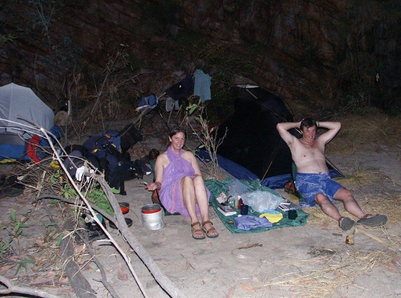
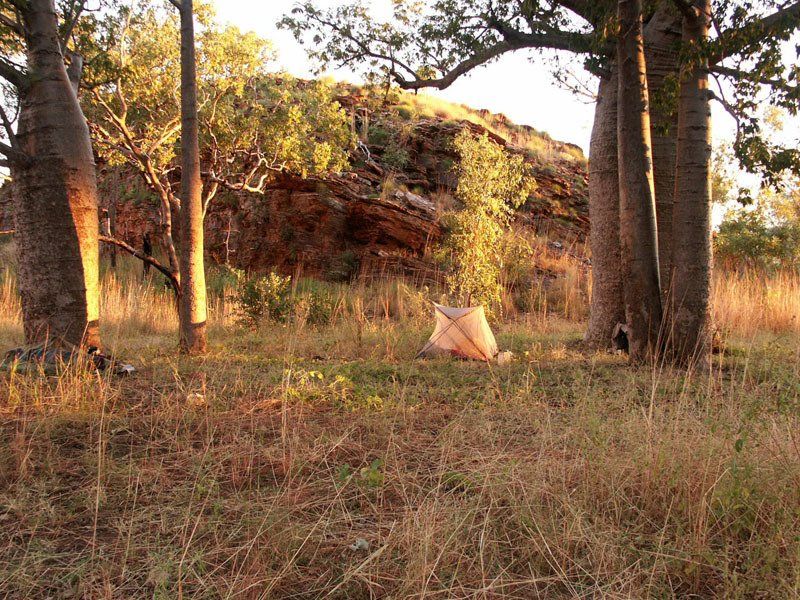
Mix of sand and rock ledges. Most sites are good to excellent but we have to avoid some of our dry season campsites which could get flooded. You are unlikely to see anyone else anywhere along the route.
ART
We have not found any art in southern range to date. There are a few minor sites in north. Few routes see more than one, some see none.
SWIMMING
Lots of beautiful pools and swimming on both sections. Pack floats are unavoidable on the first section.
WILDLIFE
The boat trip across Lake Argyle often allows you to see more wallabies than on most of the walks we do. Birds everywhere but spread out at this time of year. You are unlikely to see many large animals.
CLIMATE
Generally dry, average daytime max low 30's, average night minimum 14-18ºc, but can get below 5ºC on occasion.
COOKING
We will have camp fires every night and will have hot water available at breakfast.
WALK RATING - MODERATE TO HARD
Terrain
South.
This section includes several steep but relatively short climbs. There is a substantial amount of rock hopping and some areas are likely be fairly scrubby. There a number of fairly short, compulsory swims. Non-swimmers can float the pools on an airbed. Although much of the terrain is more rugged than most of the areas through which we walk, we have allocated extra time so that there should still be ample time to relax and enjoy the pools we find along the way.
North. The climbs on this section should not be as long and as steep as on the first section. Although there is a substantial amount of rock hopping, it should be easier than the first section. We have allocated enough time so that most groups should be able to do one or more half to full day walks without carrying a full pack.
Vegetation
Varies dramatically from year to year depending on when last burnt. If recently burnt, it’s easier than the description here. Some of the walking will be fairly open and some will be through thick grasses including spinifex, gaiters essential, long trousers recommended. Wildflowers should still be prolific.
Distance
4-6 hours per day
Pack Weight
You need to carry food for a week.
Itinerary
*This itinerary is subject to change


View more